- News
- City News
- kozhikode News
- Kerala: Farmers come up with rainfall data
Trending
This story is from August 4, 2020
Kerala: Farmers come up with rainfall data
To make up for the absence of a localized rain monitoring mechanism in Wayanad, despite the district witnessing a series of rainfall-induced disasters like landslides over the last two years, the soil conservation department here has set up a local network of 55 rain gauges for hyperlocal rainfall checks.

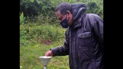
Wayanad district soil conservation department official takes readings from a rain gauge at a tea plantation in Meppadi
KOZHIKODE: To make up for the absence of a localized rain monitoring mechanism in Wayanad, despite the district witnessing a series of rainfall-induced disasters like landslides over the last two years, the soil conservation department here has set up a local network of 55 rain gauges for hyperlocal rainfall checks.
While government departments and agencies have less than 10 rainfall monitoring stations, the district soil conservation department has come up with an improvised solution by putting to use the rain gauges set up by small coffee-tea estates and other farmers, who have installed private rain gauges on their farms for agricultural purposes.
With the wide network of 55 rain gauges, the department is now able to monitor precipitation in a localized manner and it is compiling data in a single graph and sharing it with district emergency operations centre and other departments.
"Given the topographic diversity and varied rainfall patterns in various areas, we need more localized rainfall monitoring and so we roped in coffee farmers and other small scale plantations who have rain gauges on their premises to monitor rainfall for fertilizer applications," said district soil conservation officer PU Das.
"One interesting factor that has emerged from our observation of daily rainfall data is that there are four rainfall zones in the district with a high rainfall intensity zone comprising Chooralmala, the area in Padinjarathara where the control shaft of the Banasura Sagar dam is located, Vythiri, Pozhuthana and Periya. The other three rainfall zones, including Mananthavady and surrounding areas, Ambalavayal and nearby areas and Sultan Bathery have received lesser rain in descending order," he added. Das said localized rainfall monitoring will help closely track high intensity rainfall events in a particular location and help authorities react appropriately. Also, data would come handy for developmental planning and bringing changes in cropping patterns depending on precipitation.
While government departments and agencies have less than 10 rainfall monitoring stations, the district soil conservation department has come up with an improvised solution by putting to use the rain gauges set up by small coffee-tea estates and other farmers, who have installed private rain gauges on their farms for agricultural purposes.
With the wide network of 55 rain gauges, the department is now able to monitor precipitation in a localized manner and it is compiling data in a single graph and sharing it with district emergency operations centre and other departments.
"Given the topographic diversity and varied rainfall patterns in various areas, we need more localized rainfall monitoring and so we roped in coffee farmers and other small scale plantations who have rain gauges on their premises to monitor rainfall for fertilizer applications," said district soil conservation officer PU Das.
A single unit for measuring rainfall (in mm) was adopted for the entire district as many were making measurements in units like cm and inch. Now, department staff call up all private rain gauge owners or visit premises to take readings of daily rainfall which is taken at a standard time of 8am.
"One interesting factor that has emerged from our observation of daily rainfall data is that there are four rainfall zones in the district with a high rainfall intensity zone comprising Chooralmala, the area in Padinjarathara where the control shaft of the Banasura Sagar dam is located, Vythiri, Pozhuthana and Periya. The other three rainfall zones, including Mananthavady and surrounding areas, Ambalavayal and nearby areas and Sultan Bathery have received lesser rain in descending order," he added. Das said localized rainfall monitoring will help closely track high intensity rainfall events in a particular location and help authorities react appropriately. Also, data would come handy for developmental planning and bringing changes in cropping patterns depending on precipitation.
End of Article
FOLLOW US ON SOCIAL MEDIA


