Political absurdity: India on Pak’s boundary map
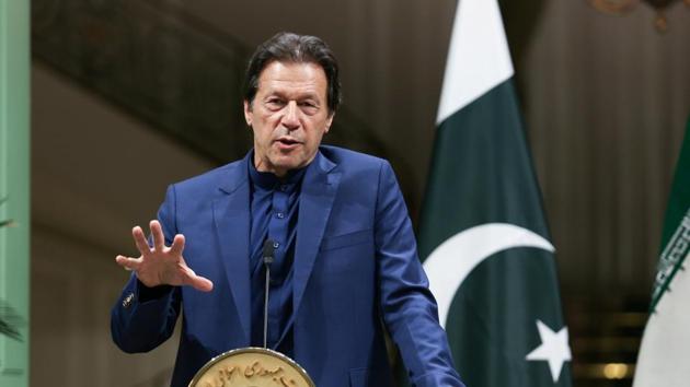
Releasing the political map during a meeting in Islamabad attended by his cabinet and senior officials, Pakistan Prime Minister Imran Khan said this was the first step towards a political struggle to achieve the right of self-determination for the Kashmiri people.
India on Tuesday described as an “exercise in political absurdity” a new map issued by Pakistan that lays claim to the Union Territories of Jammu & Kashmir and Ladakh, and Junagadh in Gujarat state, on the eve of the first anniversary of the scrapping of J&K’s special status.

Releasing the political map during a meeting in Islamabad attended by his cabinet and senior officials, Pakistan Prime Minister Imran Khan said this was the first step towards a political struggle to achieve the right of self-determination for the Kashmiri people.
Hours later, India’s external affairs ministry described the “so-called ‘political map’ of Pakistan” released by Khan as “an exercise in political absurdity, laying untenable claims to territories in the Indian state of Gujarat and our Union Territories of Jammu & Kashmir and of Ladakh”.
“These ridiculous assertions have neither legal validity nor international credibility. In fact, this new effort only confirms [the] reality of Pakistan’s obsession with territorial aggrandisement supported by cross-border terrorism,” the ministry said in a brief statement, repeating New Delhi’s assertion that Islamabad uses terror as an instrument of state policy.
Over the past few days, the Pakistani leadership has pulled out all stops to rake up the Kashmir issue ahead of the first anniversary of the Indian government’s decision on August 5, 2019 to scrap Jammu & Kashmir’s special status under Article 370 of the Constitution, and split the state into two UTs.
Pakistan’s new map includes the whole of the UT of Jammu & Kashmir as part of the country’s territory, describing it as “Indian illegally occupied Jammu and Kashmir” and a “disputed territory” whose final status is to be decided in line with UN Security Council resolutions. The boundary of Himachal Pradesh is depicted as the international border.
In a nod to China’s sensitivities, the map does not depict the Ladakh region, with a legend stating “frontier undefined”. An annotation on the map states the boundary in this area will be decided by “sovereign authorities concerned after the final settlement of the Jammu & Kashmir dispute”. During the ceremony at which the map was unveiled, Pakistan’s foreign minister Shah Mahmood Qureshi referred to the India-China border standoff in Ladakh and said Pakistan, too, has a view on the matter.
Qureshi also said the map includes Siachen glacier as part of Pakistan to challenge the region’s “illegal occupation by India”. He further said the map depicts the boundary in the disputed Sri Creek region of Gujarat according to Pakistan’s stated position on the issue to challenge India’s claim.
Khan described the unveiling of map as a “historic” move that he said was backed by his cabinet, the Kashmiri leadership and all of Pakistan’s political parties. “The move reflects the desires of the people of Pakistan and Kashmir and rejects India’s illegal action of August 5 last year,” he said, speaking in Urdu.
The new map will be “used in schools and colleges and internationally” and the “only solution to the Kashmir issue can be found under the UN Security Council resolutions, which clearly give the right to the Kashmiri people to vote on whether to go with Pakistan or India,” Khan said.
The map also depicts the Junagadh and Manavadar region of India’s Gujarat state as part of Pakistan. The nawab of Junagadh had opted to accede to Pakistan in September 1947, before fleeing from India with his family the following month. Junagadh voted overwhelmingly to stay with India in a plebiscite held in the region in 1948. Experts believe Pakistan has no legal ground for claiming the region.
India’s move to nullify Article 370 last year had triggered a strong reaction from Pakistan, with whom India’s ties were then at an all-time low following the standoff over the Pulwama terror attack. It was also opposed by Pakistan’s “iron brother” ally China, which believed it would affect its territorial claims in Ladakh, especially after India included Aksai Chin region in new maps of the union territories.
Pakistan plans to observe August 5 as “Youm-e-Istehsal” (day of exploitation) and Khan is scheduled to go to Muzaffarabad, the capital of Pakistan-occupied Kashmir (PoK), to deliver a speech. On Monday, Pakistan’s foreign and defence ministers visited areas along the Line of Control (LoC) to raise the Kashmir issue.
The Pakistani leadership has also attempted to mobilise support for its position on Kashmir from the country’s traditional allies, with only Turkish President Recep Tayyip Erdogan assuring Khan and President Arif Alvi of his country’s backing on the issue.
On Tuesday, Khan repeated his allegation that India is “trying to settle people from outside so that Kashmiris become a minority”. He added: “The map is the first step and we will launch a political struggle. We don’t believe in military solutions, we believe in political solutions.”
Qureshi also said the Kashmir Highway in Islamabad has been named the Srinagar Highway. Solidarity walks, photo exhibitions and seminars will also be organised to protest against alleged atrocities in Jammu and Kashmir, he said.
Academic Happymon Jacob, who closely tracks India-Pakistan relations, said Islamabad should “stop mouthing the worn-out platitude that it supports the Kashmiris’ right to self-determination”.
“It only seeks to wrest Kashmir from India,” he said, adding that making the LoC the international boundary “is the only solution available to either side”.
Get Current Updates on India News, Lok Sabha election 2024 live, Election 2024 along with Latest News and Top Headlines from India and around the world.


